Boulder, Colorado, nestled in the foothills of the Rocky Mountains, is a place of immense natural beauty, famed for its fantastic local breweries and only a quick trip from the bustling hub of Denver.
With skiing, world-class rock climbing, and one of the best national parks in the US – Rocky Mountain National Park a quick drive away, Boulder, a mecca for outdoor adventurers, offers some of the USA’s best hiking.

Stunning mountain views surround the city with a labyrinth of hiking trails. While the trails are very accessible, it can be easy for first-time visitors to get lost. This guide cuts to the chase, covering the very best hiking trails near Boulder to help you make the most of your time in this pristine wilderness region.
Boulder
Culturally, Boulder is a college town with an eclectic mix of crunchy moms, keg standing college kids, and world-class athletes drawn to the great outdoors. The city is surrounded by urbanites of Denver and true mountain folk of the high country.
Tourism reigns supreme downtown on Pearl Street, but those who arrive with a good pair of hiking boots will reap the rewards of Boulders real treasures. A great day hike in the crisp mountain air finishing with a cold local beer and an empanada at one of Boulders popular local breweries such as Upslope is genuinely the best way to enjoy the city.
Rocky Mountain Trail Tips
Before venturing off into the Colorado wilderness, there are a couple of important things to keep in mind to ensure a safe and enjoyable hike.
Check The Weather
All trails listed below are accessible in all seasons, but pay special attention to a few things when looking at the local forecast before lacing up the hiking boots and setting off.
Be aware that most storms roll in in the afternoon. Thunderstorms are rare but are no joke, sometimes bringing golf ball-sized hail that will crack the window of a car. Storms will come and go quickly so check the hourly forecast, to avoid getting stuck an hour away from the trailhead during a downpour.
Winter winds can make higher and unprotected peaks like Bear Peak extremely unpleasant. Pay attention to the wind forecast before choosing a hike in cold conditions.
Finally, while all trails are accessible in all seasons, come prepared with microspikes for snow hiking. Some of the more rocky trails such as Royal Arch and Sanitas might not be safe without proper equipment.

Download a Hiking App Before You Go
AllTrails is the best app to make the most of Boulder hiking. Cell signal is fair on most hikes with major carriers and the app will let you know if you are just a few steps off-trail. The pro version allows users to download the trail map and rely on GPS alone to navigate.
While each trail listed below is pretty well marked, there are definitely tricky spots and intersections where an app like AllTrails will make things much easier.
Additionally, because hiking is such a way of life around Boulder, users post updates on the most popular trail conditions in the comments daily so you can get real-time condition reports.
See our Hiking Packing Guide before packing for your next hiking vacation.
Top Boulder Day Hikes
The trails below are all rated as moderate or difficult and require at least a few hours to complete. There are family-friendly and accessible hikes in Boulder, but this list focuses on the most epic views through the varied terrain with the best chance to see wildlife.
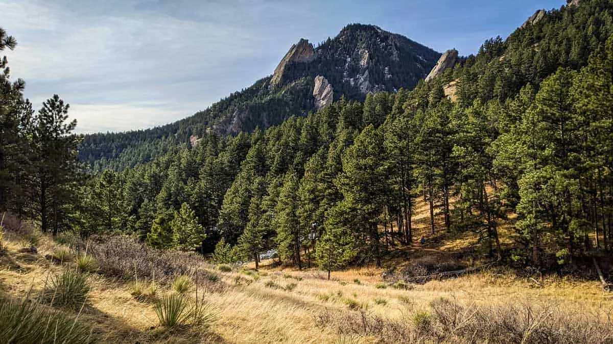
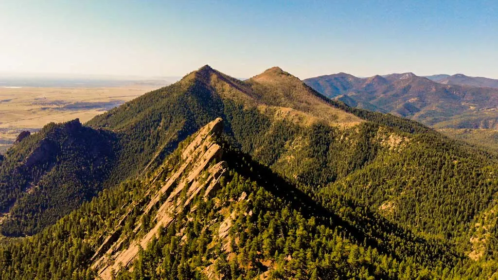
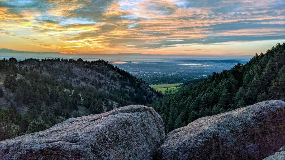
Bear Peak (8 miles, 2,800ft elevation gain)
NCAR
Beginning at the National Center for Atmospheric Research, or NCAR, which is a destination in itself, Bear Peak is the most difficult and most rewarding hike on the list. There are over 10 different routes to reach Bear Peak, but the thigh-burning climb through Fern Canyon followed by the gradual descent with views of the backcountry via the West Ridge Trail is widely regarded as the classic.
Fern Canyon
The trail begins with a picturesque view beside the foothills of the mountain before a challenging and intense incline through Fern Canyon. Fern Canyon begins with green, pleasantly forested switchbacks that are eventually and curiously replaced by a near-vertical ascent and short scramble to the breathtaking summit at Bear Peak.
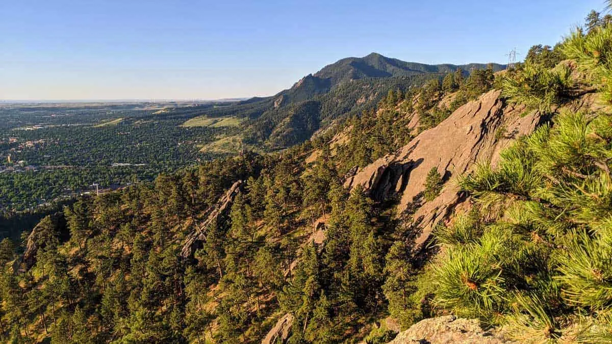
Bear Peak
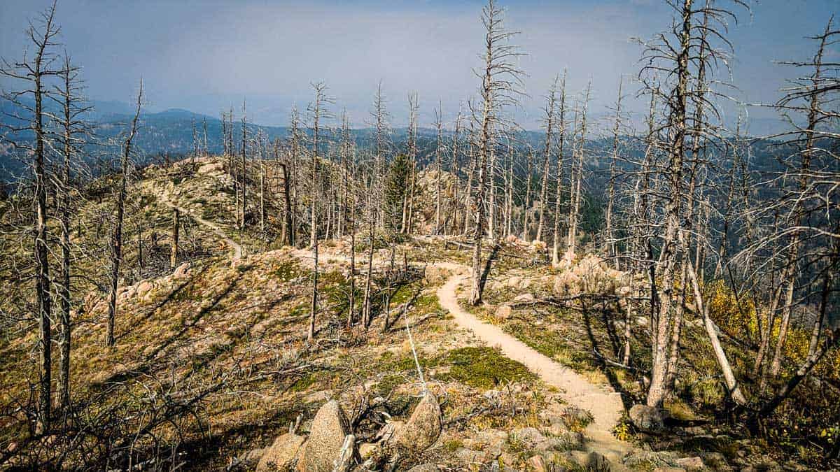
Aside from the summit’s views, the highlight is the varied terrain, from open meadows and wildflowers to rugged boulders. There is a fire-ravaged valley on the descent which is often extremely windy, offering a stunning post-apocalyptic aura. The trail continues into a contrastingly serene wind-protected green section with great side trails and outlooks perfect for a mid-hike picnic.

Finally, the trail concludes with an easy stroll through the forest canyon alongside a bubbling creek on the way back to the trailhead.

Note: AllTrails suggests taking the counterclockwise route through West Ridge Trail. This is a mistake unless you have bionic knees impervious to smashing joints down a rocky climb on the return. Go clockwise. See more information on Bear Peak Trails here.
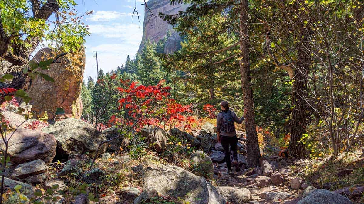
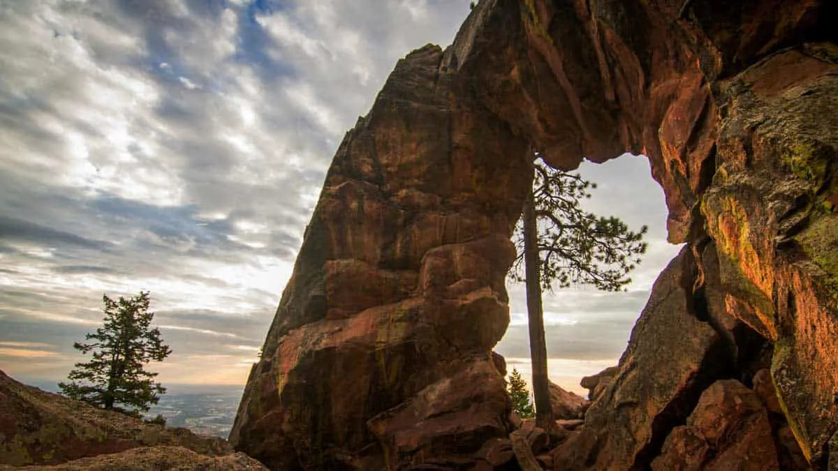
Royal Arch (4 miles, 1,500ft elevation gain)

Chautauqua Park
The Royal Arch trail starts at the historic local landmark of Chautauqua Park. In 1898 residents purchased alfalfa fields and apple orchards which would become the first Boulder County Open Space. Today over 45,000 acres of land in Boulder County has been designated as open space for preservation and protection. The initiative maintains the natural beauty and habitat for local wildlife that makes Boulder the attraction it is today.
In addition to being a historical landmark, Chautauqua Park trailhead is also the starting point for several trails. The spaghetti bowl of a trail network at the base can be confusing. Fortunately, trails are well marked at major intersections, but it is still best to follow a map or an app.
Royal Arch
The Royal Arch hike takes trampers through a conifer forest with beautifully coloured lichen on the sedimentary rock. After a tiring climb, the trail teases hikers with a false summit at Sentinel Pass. At roughly two thirds through the hike, it may be tempting to call it a day at Sentinel Pass and soak in the lovely views, but completing the hike is worth the reward of the unique rock formation near Boulder.
Note: The trailhead is busy so expect a crowd, and if arriving mid-day on a weekend, expect to park in the street. Street parking may require a $2.50/hour fee. See more information on Royal Arch Hike here.
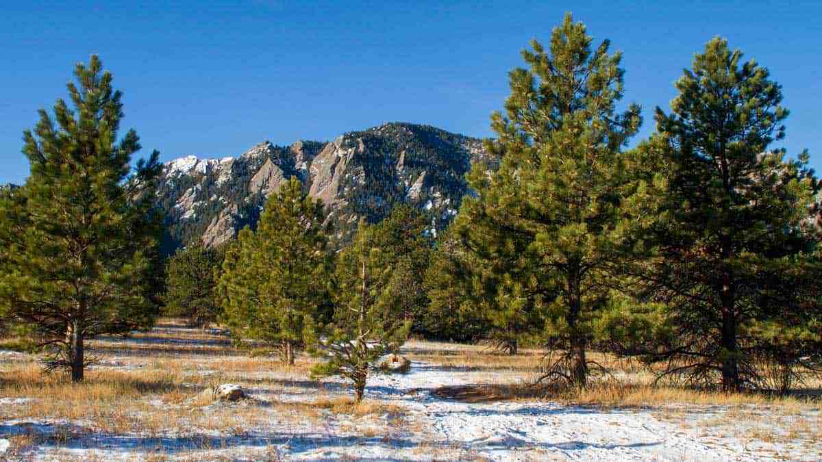
Mount Sanitas (3.2 miles, 1,200ft elevation gain)
What’s better than hiking Mount Sanitas and finishing with a beer from Sanitas Brewery and some food truck tacos? Mount Sanitas is Boulder’s most popular hike with many options to reach the summit. The distance is perfect as both a quick training workout for athletes and a good introduction hike for those still acclimating to the altitude. This hike is the most approachable of those rated difficult on this list.
The loop takes hikers through flagstone rock outcroppings past gnarly trees to the summit and then cuts through the center of the valley speckled with beautiful wild flowers on the return.
The peak features views of the entire city of Boulder on one side and endless views of the mountains and valleys on the other. The climb features mostly flagstone stairs. In colder weather, the descent can be slippery on occasional ice and packed snow so microspikes are recommended.
Note: There is one very confusing portion of the trail on the descent. There is a sign that says “Stay On Trail” with an arrow pointing down. At this point, turn left as if walking into what seems like a crevice in the boulder. Do not follow the worn path straight ahead, as this is the path of hundreds of previous hikers going the wrong way. Get complete trail information for Mount Sanitas here.
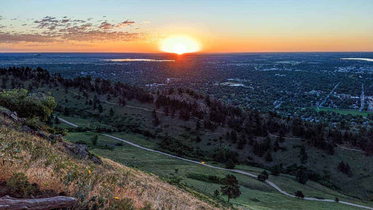
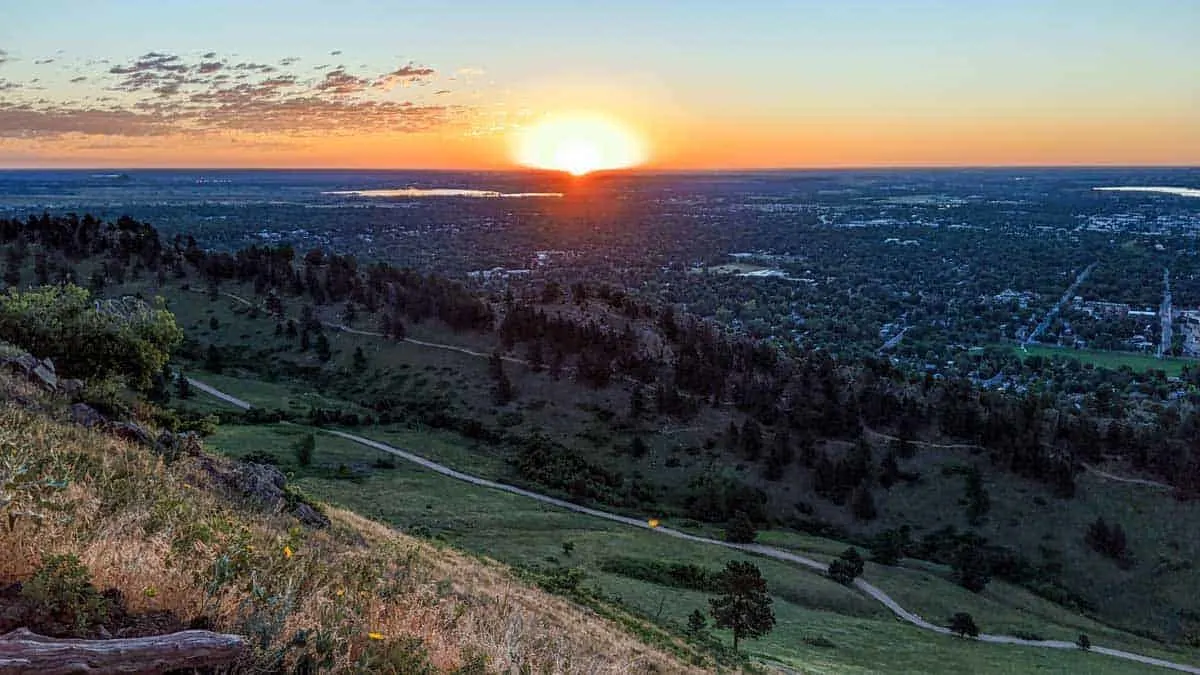
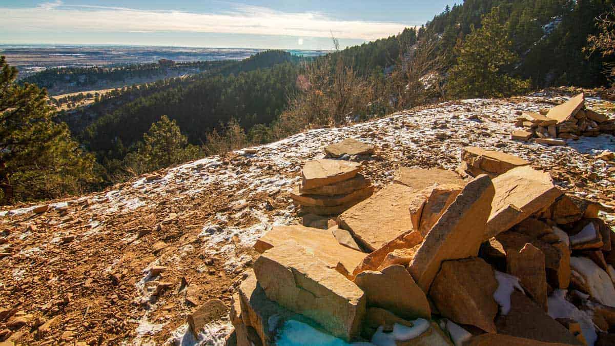
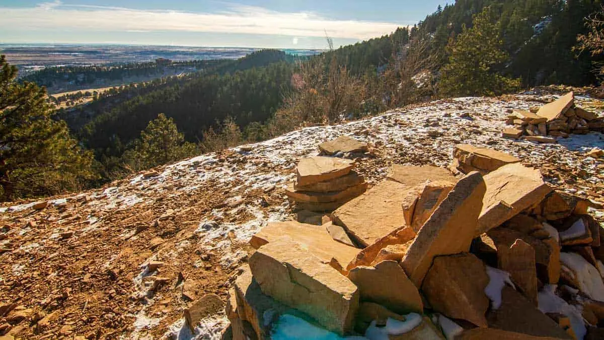
Green Mountain (4 miles, 1,500 ft elevation gain)

The Green Mountain loop is an underappreciated hike to one of the best views near Boulder. Perhaps just as interesting as the hike is the drive up Flagstaff Road to the trailhead.
This hike is especially good on hot or windy days as it is shade covered almost the entire way. While it does mean less time gawking at the amazing views, this hike offers the best opportunity to see local wildlife. There are also several points along the way with stunning overlooks either of the city or of the high country mountain range.

After the hike, continue up Flagstaff Road to Lost Gulch Overlook for the best roadside view in Boulder and perhaps the most picturesque location in the county. The only risk is you may pinch yourself for spending a few hours hiking when a view so good is literally right next to the road.
Note: There is a $5.00 daily parking fee that is good for both the trailhead and the overlook. The self-service kiosk at the trailhead is located across the street at the Realization Point parking lot. See here for more Green Mountain Hike details.
Woods Quarry and Mesa Trail Loop (3.1 miles, 872 ft elevation gain)
For those looking for a moderate hike with a unique view of the city, Woods Quarry is another local gem not as heavily trafficked as other trails in the area. Free street parking next to the trailhead is a welcome change to many of the other overcrowded parking lots. The Woods Quarry trail is also the best hike in Boulder for dogs, so expect a few other four-legged friends along the route.
Hikers begin up a grassy hill overlooking a quaint cemetary into a well shaded forestland. There are a few great photo opportunities along the way as the well spaced pine trees along the trail frame the flatirons ahead.

It continues to the Enchanted Mesa Loop, which lives up to its name as a shadowy jaunt through the coniferous forest. Please don’t skip the hike’s final leg up to Woods Quarry as it offers one of the most unique and relaxing views overlooking the valley to NCAR. A great midpoint is enjoying a packed lunch and a cold drink while sitting on the stone chairs assembled in the rock quarry by previous hikers. Get more information on the Woods Quarry and Messa Loop Trail here.
About the Author
Mike Baron
Mike is an outdoor enthusiast, husband, and father of three wild boys. When he’s not outside, he’s usually writing about it, either on his own Family Travel Blog, FivePax, or as a freelance travel writer.